
ملف:Levantine Sea.jpg
لا توجد دقة أعلى متوفرة.
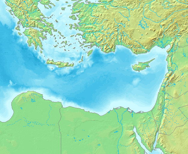
Levantine_Sea.jpg (627 × 512 بكسل حجم الملف: 139 كيلوبايت، نوع MIME: image/jpeg)
| هذا ملف من ويكيميديا كومنز. معلومات من صفحة وصفه مبينة في الأسفل. كومنز مستودع ملفات ميديا ذو رخصة حرة. |
| الوصف |
|
||||
| المصدر | own work based on PD map | ||||
| المؤلف | edited by w:nl:hanhil | ||||
| الترخيص (إعادة استخدام هذا الملف) |
|
تاريخ الملف
اضغط على زمن/تاريخ لرؤية الملف كما بدا في هذا الزمن.
| زمن/تاريخ | صورة مصغرة | الأبعاد | مستخدم | تعليق | |
|---|---|---|---|---|---|
| حالي | 20:49، 14 أبريل 2007 | | 627 × 512 (139 كيلوبايت) | Hanhil | {{Information |Description= *{{en|Levantine Sea}} *{{nl|Levantijnse Zee}} *{{de|Levantinisches Meer}} |Source= own work based on PD map |Date= |Author= edited by w:nl:hanhil |Permission= {{PD-Demis}} |other_versions= }} |
استخدام الملف
الصفحتان التاليتان تستخدمان هذا الملف:
الاستخدام العالمي للملف
الويكيات الأخرى التالية تستخدم هذا الملف:
- الاستخدام في af.wikipedia.org
- الاستخدام في azb.wikipedia.org
- الاستخدام في az.wikipedia.org
- الاستخدام في be.wikipedia.org
- الاستخدام في bs.wikipedia.org
- الاستخدام في cv.wikipedia.org
- الاستخدام في da.wikipedia.org
- الاستخدام في de.wikipedia.org
- الاستخدام في diq.wikipedia.org
- الاستخدام في en.wikipedia.org
- الاستخدام في eo.wikipedia.org
- الاستخدام في es.wikipedia.org
- الاستخدام في eu.wikipedia.org
- الاستخدام في fa.wikipedia.org
- الاستخدام في fr.wikipedia.org
- الاستخدام في fy.wikipedia.org
- الاستخدام في he.wikipedia.org
- الاستخدام في ie.wikipedia.org
- الاستخدام في ilo.wikipedia.org
- الاستخدام في is.wikipedia.org
- الاستخدام في it.wikipedia.org
- الاستخدام في ja.wikipedia.org
- الاستخدام في ko.wikipedia.org
- الاستخدام في la.wikipedia.org
اعرض المزيد من الاستخدام العام لهذا الملف.