
ملف:MINURSO Deployment (April 2014).png
الملف الأصلي (2٬278 × 2٬779 بكسل حجم الملف: 973 كيلوبايت، نوع MIME: image/png)
| هذا ملف من ويكيميديا كومنز. معلومات من صفحة وصفه مبينة في الأسفل. كومنز مستودع ملفات ميديا ذو رخصة حرة. |

|
هذه map الصورة / الصورتان باستعمال رسومات متجهية ملفات رسوميات شعاعية.
It is recommended to name the SVG file "MINURSO Deployment (April 2014).svg" - then the template Vector version available (or Vva) does not need the new image name parameter.
|
ملخص
| الوصف |
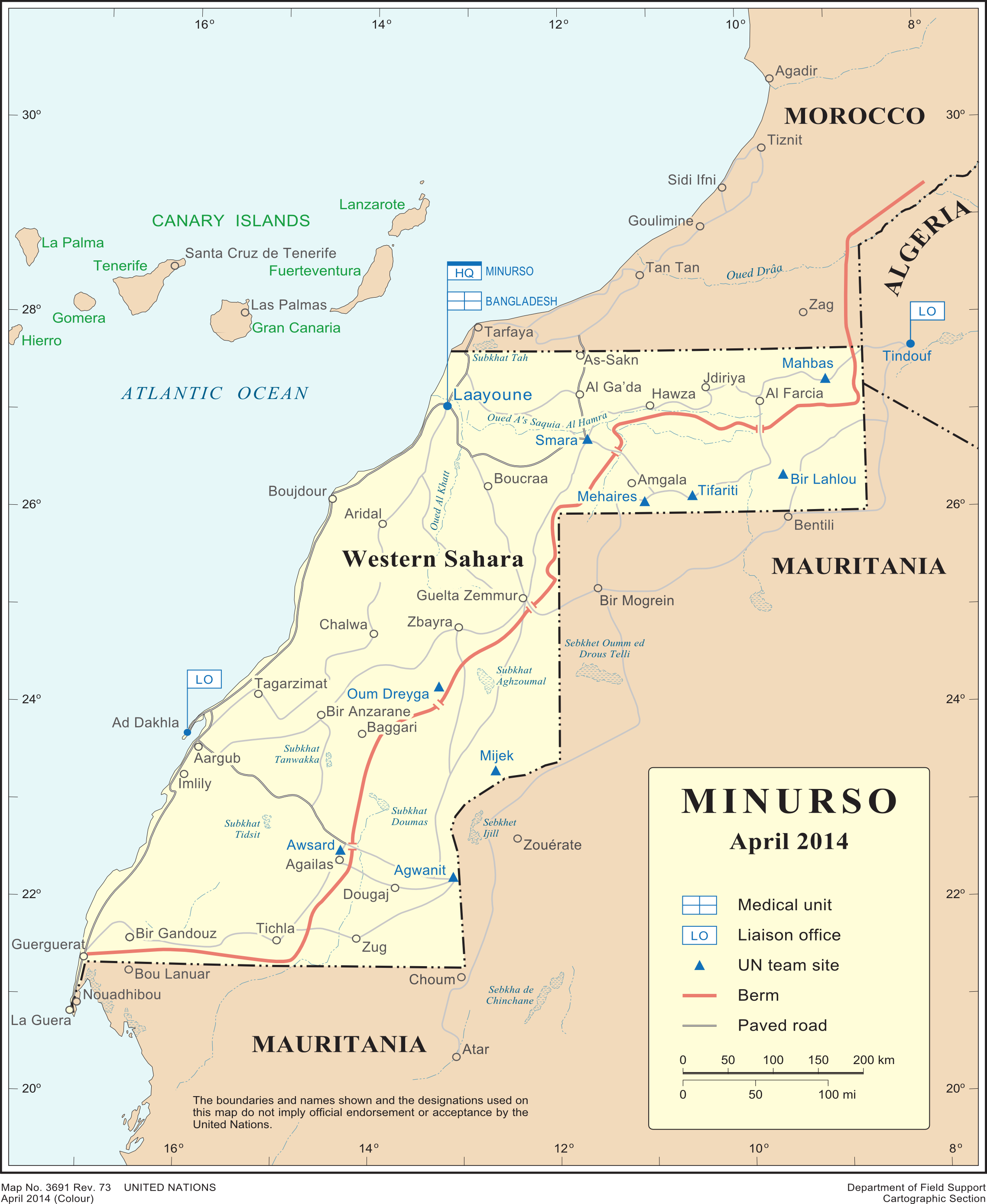
English: Deployment of MINURSO, as of April 2014
Français : Déploiement de la Minurso au Sahara occidental |
| التاريخ | |
| المصدر | [1], which had not been changed as of Sept 2019 |
| المؤلف | United Nations Cartographic Section |
| إصدارات أخرى |
|

.png)
ترخيص
| This image is a map derived from a United Nations map.
Unless stated otherwise, UN maps are to be considered in the public domain. This applies worldwide. UN maps are, in principle, open source material and you can use them in your work or for making your own map. UN requests however that you delete the UN name, logo and reference number upon any modification to the map. Content of your map will be your responsibility. You can state in your publication, if you wish, something like: based on UN map … (map name, map number, revision number and date). See: Geospatial Information Section. And: Geospatial, location data for a better world. |
 |
تاريخ الملف
اضغط على زمن/تاريخ لرؤية الملف كما بدا في هذا الزمن.
| زمن/تاريخ | صورة مصغرة | الأبعاد | مستخدم | تعليق | |
|---|---|---|---|---|---|
| حالي | 11:29، 17 أبريل 2015 | | 2٬278 × 2٬779 (973 كيلوبايت) | Treehill | User created page with UploadWizard |
استخدام الملف
الصفحة التالية تستخدم هذا الملف:
الاستخدام العالمي للملف
الويكيات الأخرى التالية تستخدم هذا الملف:
- الاستخدام في ca.wikipedia.org
- الاستخدام في el.wikipedia.org
- الاستخدام في en.wikipedia.org
- الاستخدام في fr.wikipedia.org
- الاستخدام في ja.wikipedia.org
- الاستخدام في nl.wikipedia.org
- الاستخدام في pl.wikipedia.org
- الاستخدام في ru.wikipedia.org
- الاستخدام في www.wikidata.org
.png)