
ملف:Western Indian Wars.jpg
حجم هذه المعاينة: 785 × 600 بكسل. الأبعاد الأخرى: 314 × 240 بكسل | 629 × 480 بكسل | 1٬006 × 768 بكسل | 1٬280 × 978 بكسل | 2٬006 × 1٬532 بكسل.
الملف الأصلي (2٬006 × 1٬532 بكسل حجم الملف: 425 كيلوبايت، نوع MIME: image/jpeg)
| هذا ملف من ويكيميديا كومنز. معلومات من صفحة وصفه مبينة في الأسفل. كومنز مستودع ملفات ميديا ذو رخصة حرة. |
| الوصف |
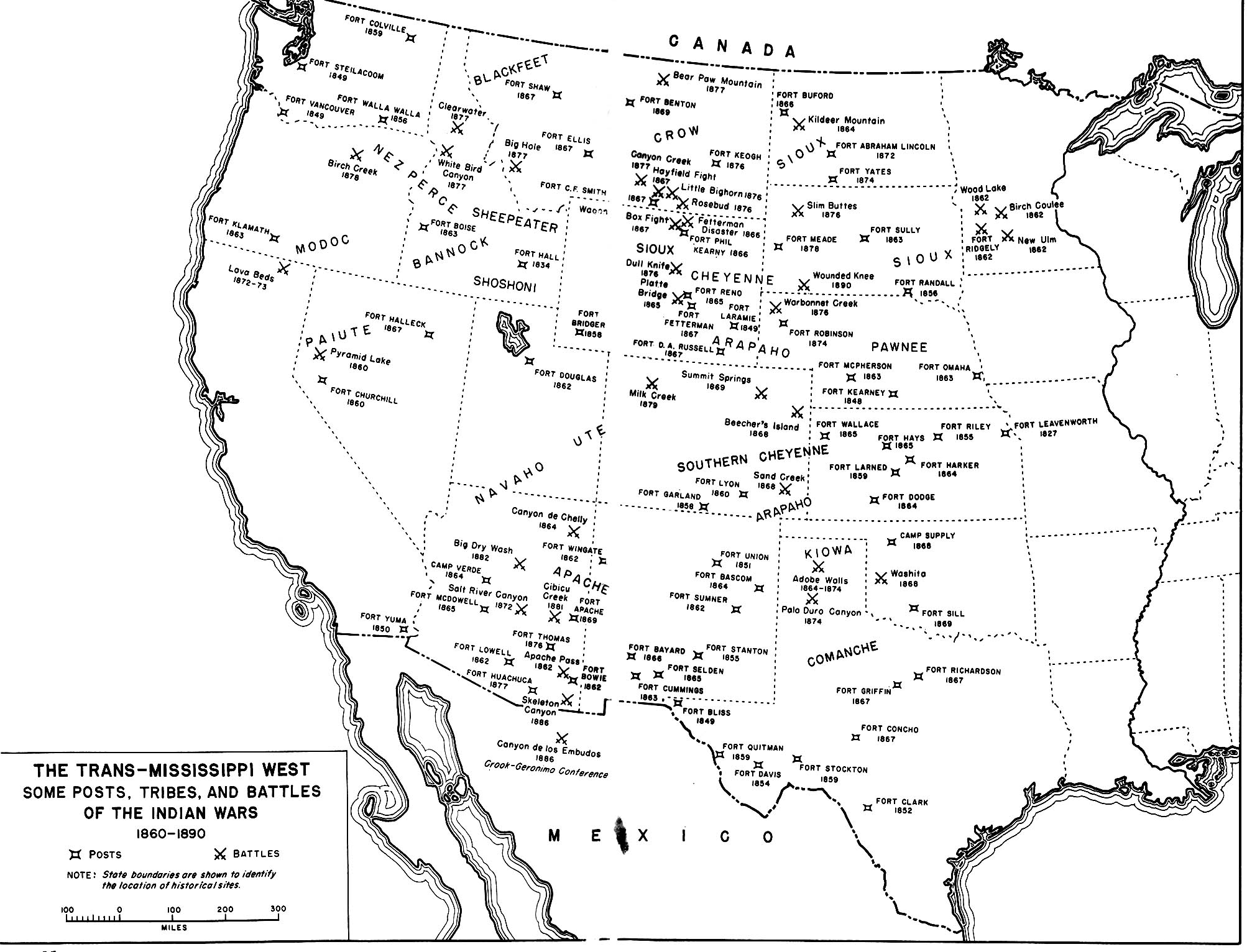
English: A map of the En:Indian Wars in the Western United States showing the general location of tribes and the location of some army posts and battles. Map 35 in Chapter 14 Winning the West: The Army in the Indian Wars, 1865-1890 AMERICAN MILITARY HISTORY ARMY HISTORICAL SERIES OFFICE OF THE CHIEF OF MILITARY HISTORY UNITED STATES ARMY |
|||
| المصدر | http://www.history.army.mil/books/amh/Map14-35.jpg | |||
| المؤلف | Work of the United States government | |||
| الترخيص (إعادة استخدام هذا الملف) |
|

تاريخ الملف
اضغط على زمن/تاريخ لرؤية الملف كما بدا في هذا الزمن.
| زمن/تاريخ | صورة مصغرة | الأبعاد | مستخدم | تعليق | |
|---|---|---|---|---|---|
| حالي | 01:35، 26 يوليو 2009 | | 2٬006 × 1٬532 (425 كيلوبايت) | Fred Bauder | {{Information |Description={{en|1=A map of the En:Indian Wars in the Western United States showing the general location of tribes and the location of some army posts and battles. Map 35 in Chapter 14 Winning the West: The Army in the Indian Wars, 1865 |
استخدام الملف
الصفحة التالية تستخدم هذا الملف:
الاستخدام العالمي للملف
الويكيات الأخرى التالية تستخدم هذا الملف:
- الاستخدام في ca.wikipedia.org
- الاستخدام في en.wikipedia.org
- الاستخدام في en.wikiquote.org
- الاستخدام في fr.wikipedia.org
- الاستخدام في sv.wikipedia.org
- الاستخدام في tr.wikipedia.org
- الاستخدام في uk.wikipedia.org