
ملف:Belle-terre-map.png
لا توجد دقة أعلى متوفرة.
Belle-terre-map.png (575 × 425 بكسل حجم الملف: 35 كيلوبايت، نوع MIME: image/png)
| هذا ملف من ويكيميديا كومنز. معلومات من صفحة وصفه مبينة في الأسفل. كومنز مستودع ملفات ميديا ذو رخصة حرة. |
| الوصف | |
| التاريخ | |
| المصدر | http://factfinder.census.gov |
| المؤلف | United States Census Bureau |
| الترخيص (إعادة استخدام هذا الملف) |
Public domain |
ترخيص
This image or file is a work of a United States Census Bureau employee, taken or made as part of that person's official duties. As a work of the U.S. federal government, the image is in the public domain.
|
 |
سجلُّ الرَّفع الأصيل
صفحة الوصف الأصلية كانت هنا، تشير جميع أسماء المستخدمين التالية إلى en.wikipedia.
- 2007-11-28 02:17 Americasroof 575×425× (36454 bytes) [[Bellerose Terrace, New York]] from U.S. Census
- 2007-11-19 23:52 Americasroof 575×425× (36454 bytes) [[Belle Terre, New York]] map from U.S. Census
سجلُّ الرَّفع الأصيل
| زمن/تاريخ | الأبعاد | مستخدم | تعليق |
|---|---|---|---|
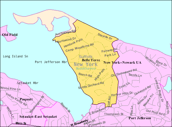
| ٢٣ أغسطس ٢٠١٣, ٠٤:٥٧:٢٨ | 575 × 425 (36454 bytes) | Dcirovic (نقاش · مساهمات) | {{Information |Description={{en|[[:en:U.S. Census 2000|]] reference map for [[:en:Belle Terre, New York|]]}} |Source=Transferred from [http://en.wikipedia.org en.wikipedia]<br/> (Original text : ''http://factfinder.census.gov'') |Date=2007<br/> ({{Orig... |
تاريخ الملف
اضغط على زمن/تاريخ لرؤية الملف كما بدا في هذا الزمن.
| زمن/تاريخ | صورة مصغرة | الأبعاد | مستخدم | تعليق | |
|---|---|---|---|---|---|
| حالي | 01:09، 24 أغسطس 2014 | | 575 × 425 (35 كيلوبايت) | GifTagger | Bot: Converting file to superior PNG file. (Source: Belle-terre-map.gif). This GIF was problematic due to non-greyscale color table. |
استخدام الملف
الصفحة التالية تستخدم هذا الملف:
الاستخدام العالمي للملف
الويكيات الأخرى التالية تستخدم هذا الملف:
- الاستخدام في ca.wikipedia.org
- الاستخدام في cy.wikipedia.org
- الاستخدام في en.wikipedia.org
- الاستخدام في es.wikipedia.org
- الاستخدام في eu.wikipedia.org
- الاستخدام في fr.wikipedia.org
- الاستخدام في ht.wikipedia.org
- الاستخدام في sh.wikipedia.org
- الاستخدام في sr.wikipedia.org
- الاستخدام في www.wikidata.org