
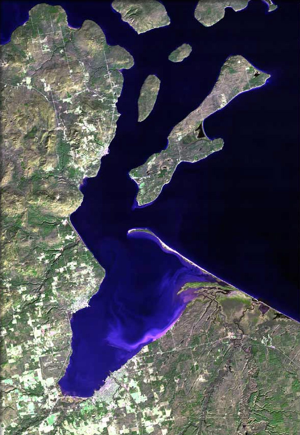
ملف:Chequamegon Bay map.jpg
حجم هذه المعاينة: 413 × 599 بكسل. البعدان الآخران: 165 × 240 بكسل | 590 × 856 بكسل.
الملف الأصلي (590 × 856 بكسل حجم الملف: 216 كيلوبايت، نوع MIME: image/jpeg)
| هذا ملف من ويكيميديا كومنز. معلومات من صفحة وصفه مبينة في الأسفل. كومنز مستودع ملفات ميديا ذو رخصة حرة. |
| الوصف | The raw satellite imagery shown in these images was obtain from NASA and/or the US Geological Survey. Post-processing and production by www.terraprints.com |
| التاريخ | |
| المصدر | www.terraprints.com |
| المؤلف | http://www.terraprints.com |
| إصدارات أخرى |
.jpg)
هذا الملف مُرخص تحت رخصة المشاع المبدع نسبة المصنف إلى مؤلفه 2.5 العامة
- يحقُّ لك:
- مشاركة العمل – نسخ العمل وتوزيعه وبثُّه
- إعادة إنتاج العمل – تعديل العمل
- حسب الشروط التالية:
- نسب العمل إلى مُؤَلِّفه – يلزم نسب العمل إلى مُؤَلِّفه بشكل مناسب وتوفير رابط للرخصة وتحديد ما إذا أجريت تغييرات. بالإمكان القيام بذلك بأية طريقة معقولة، ولكن ليس بأية طريقة تشير إلى أن المرخِّص يوافقك على الاستعمال.
تاريخ الملف
اضغط على زمن/تاريخ لرؤية الملف كما بدا في هذا الزمن.
| زمن/تاريخ | صورة مصغرة | الأبعاد | مستخدم | تعليق | |
|---|---|---|---|---|---|
| حالي | 14:14، 7 أبريل 2011 | | 590 × 856 (216 كيلوبايت) | Ras67 | cropped |
| 18:30، 25 أكتوبر 2006 |  | 669 × 1٬000 (92 كيلوبايت) | Terraprints | {{Information |Description=The raw satellite imagery shown in these images was obtain from NASA and/or the US Geological Survey. Post-processing and production by http://www.terraprints.com |Source=http://www.terraprints.com |Date=20061025 |Author=http:// |
استخدام الملف
الصفحة التالية تستخدم هذا الملف:
الاستخدام العالمي للملف
الويكيات الأخرى التالية تستخدم هذا الملف:
- الاستخدام في ceb.wikipedia.org
- الاستخدام في en.wikipedia.org
- Odanah, Wisconsin
- Sanborn, Wisconsin
- Ashland (town), Wisconsin
- Ashland, Wisconsin
- Bayfield (town), Wisconsin
- Washburn, Bayfield County, Wisconsin
- Washburn, Wisconsin
- Bayfield, Wisconsin
- Apostle Islands
- Chequamegon Bay
- Red Cliff, Wisconsin
- Salmo, Wisconsin
- Birch Hill, Wisconsin
- Diaperville, Wisconsin
- Franks Field, Wisconsin
- New Odanah, Wisconsin
- Pureair, Wisconsin
- Birch, Ashland County, Wisconsin
- Book Across the Bay
- PS City of Ashland
- Template:Chequamegon Bay
- User:DNOVAK25/sandbox
- Apostle Islands Sled Dog Race
- Applefest (Bayfield, Wisconsin)
- Antelope (shipwreck)
- الاستخدام في en.wikiquote.org
- الاستخدام في es.wikipedia.org
- الاستخدام في fr.wikipedia.org
- الاستخدام في www.wikidata.org