
ملف:Isle of Wight UK location map.svg

حجم معاينة PNG لذلك الملف ذي الامتداد SVG: 800 × 487 بكسل. الأبعاد الأخرى: 320 × 195 بكسل | 640 × 390 بكسل | 1٬024 × 624 بكسل | 1٬280 × 780 بكسل | 2٬560 × 1٬559 بكسل | 1٬425 × 868 بكسل.
الملف الأصلي (ملف SVG، أبعاده 1٬425 × 868 بكسل، حجم الملف: 843 كيلوبايت)
| هذا ملف من ويكيميديا كومنز. معلومات من صفحة وصفه مبينة في الأسفل.
كومنز مستودع ملفات ميديا ذو رخصة حرة. |
| الوصف |
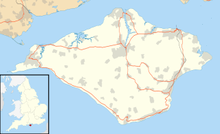
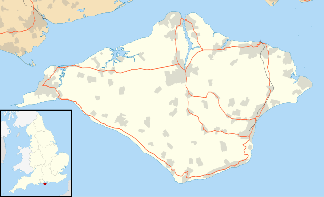
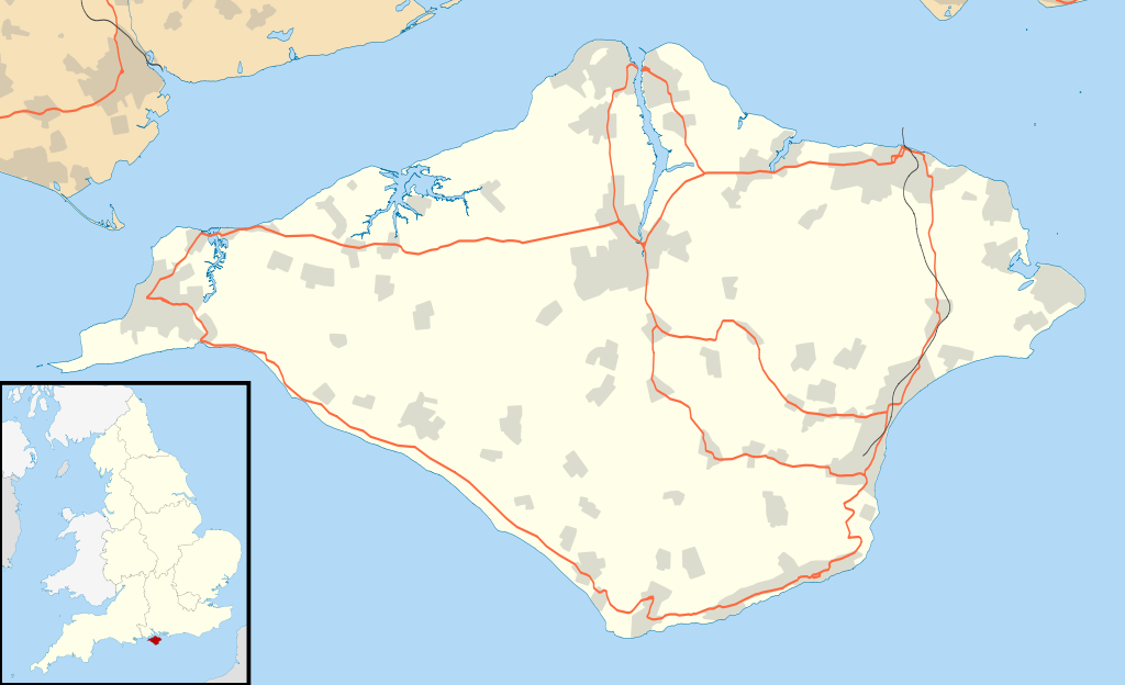
Map of the Isle of Wight, UK with the following information shown:
Equirectangular map projection on WGS 84 datum, with N/S stretched 155% Geographic limits:
|
| التاريخ | |
| المصدر |
|
| المؤلف | Nilfanion, created using Ordnance Survey data |
| الترخيص (إعادة استخدام هذا الملف) |
هذا الملفُّ مُرخَّص بموجب رخصة المشاع الإبداعي نسبة المُصنَّف إِلى مُؤَلِّفه - المشاركة بالمثل 3.0 العامة نسب العمل لمُؤَلِّفه: Contains Ordnance Survey data © Crown copyright and database right
|
| إصدارات أخرى | File:Isle of Wight UK district map (blank).svg - Blank map |
.svg)
تاريخ الملف
اضغط على زمن/تاريخ لرؤية الملف كما بدا في هذا الزمن.
| زمن/تاريخ | صورة مصغرة | الأبعاد | مستخدم | تعليق | |
|---|---|---|---|---|---|
| حالي | 18:56، 26 سبتمبر 2010 | | 1٬425 × 868 (843 كيلوبايت) | Nilfanion | {{Information |Description=Map of the Isle of Wight, UK with the following information shown: *Administrative borders *Coastline, lakes and rivers *Roads and railways *Urban areas Equirectangular map projection on WGS 84 datum, with N |
استخدام الملف
الصفحة التالية تستخدم هذا الملف:
الاستخدام العالمي للملف
الويكيات الأخرى التالية تستخدم هذا الملف:
- الاستخدام في bg.wikipedia.org
- الاستخدام في ceb.wikipedia.org
- الاستخدام في en.wikipedia.org
- Osborne House
- Carisbrooke Castle
- Sandown
- Newport, Isle of Wight
- Cowes
- Ventnor
- Yarmouth, Isle of Wight
- Ryde
- Shanklin
- Blackgang Chine
- East Cowes
- Bembridge
- Brading
- St Helens Fort
- No Man's Land Fort
- Yarmouth Castle
- Fort Albert
- Fort Victoria, Isle of Wight
- Golden Hill Fort
- St Lawrence, Isle of Wight
- The Needles Batteries
- Freshwater, Isle of Wight
- Niton
- Fishbourne, Isle of Wight
- Wootton Bridge
- Appuldurcombe House
- Wroxall, Isle of Wight
- List of places on the Isle of Wight
- Newtown, Isle of Wight
- Arreton
- Chillerton Down transmitting station
- St Helens, Isle of Wight
- Carisbrooke
- Whitwell, Isle of Wight
- Sandown Bay
- Ningwood
- Binstead
- Totland
- Shalfleet
- Cranmore, Isle of Wight
- Brook, Isle of Wight
- Wellow, Isle of Wight
- Blackwater, Isle of Wight
- Kingston, Isle of Wight
- Gatcombe
- Shorwell
- Newchurch, Isle of Wight
- Chale
اعرض المزيد من الاستخدام العام لهذا الملف.