
ملف:Map of Sullivan County Indiana Townships.svg

حجم معاينة PNG لذلك الملف ذي الامتداد SVG: 512 × 512 بكسل. الأبعاد الأخرى: 240 × 240 بكسل | 480 × 480 بكسل | 768 × 768 بكسل | 1٬024 × 1٬024 بكسل | 2٬048 × 2٬048 بكسل.
الملف الأصلي (ملف SVG، أبعاده 512 × 512 بكسل، حجم الملف: 53 كيلوبايت)
| هذا ملف من ويكيميديا كومنز. معلومات من صفحة وصفه مبينة في الأسفل. كومنز مستودع ملفات ميديا ذو رخصة حرة. |
| الوصف |
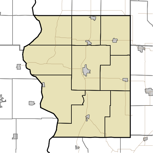
English: This is a map of the townships in Sullivan County, Indiana, USA. |
| التاريخ | (UTC) |
| المصدر | |
| المؤلف |
|
أنا، صاحب حقوق التأليف والنشر لهذا العمل، أنشر هذا العمل تحت الرخصة التالية:
| أنا، مالِك حقوق تأليف ونشر هذا العمل، أجعله في النِّطاق العامِّ، يسري هذا في أرجاء العالم كلِّه. في بعض البلدان، قد يكون هذا التَّرخيص غيرَ مُمكنٍ قانونيَّاً، في هذه الحالة: أمنح الجميع حق استخدام هذا العمل لأي غرض دون أي شرط ما لم يفرض القانون شروطًا إضافية. |
سجلُّ الرَّفع الأصيل
This image is a derivative work of the following images:
- File:Map_highlighting_Cass_Township,_Sullivan_County,_Indiana.svg licensed with PD-self
- 2007-11-24T20:01:54Z File Upload Bot (Omnedon) 512x512 (26387 Bytes) == Summary == {{Information |Description={{en|This is a map of Sullivan County, Indiana, USA which highlights the location of Cass Township.}} |Source=My own work, using freely-available TIGER data and custom-written MapScri
Uploaded with derivativeFX
تاريخ الملف
اضغط على زمن/تاريخ لرؤية الملف كما بدا في هذا الزمن.
| زمن/تاريخ | صورة مصغرة | الأبعاد | مستخدم | تعليق | |
|---|---|---|---|---|---|
| حالي | 18:17، 17 أغسطس 2010 | | 512 × 512 (53 كيلوبايت) | Sweet kate | {{Information |Description={{en|This is a map of the townships in Sullivan County, Indiana, USA.}} |Source=*File:Map_highlighting_Cass_Township,_Sullivan_County,_Indiana.svg |Date=2010-08-17 18:13 (UTC) |Author=*[[:File:Map_highlighting_Cass_Townshi |
استخدام الملف
الصفحة التالية تستخدم هذا الملف:
الاستخدام العالمي للملف
الويكيات الأخرى التالية تستخدم هذا الملف:
- الاستخدام في azb.wikipedia.org
- الاستخدام في ceb.wikipedia.org
- الاستخدام في en.wikipedia.org
- Union Christian College, Merom
- Cass, Indiana
- Fairbanks, Indiana
- Graysville, Indiana
- Jackson Hill, Indiana
- New Lebanon, Indiana
- Paxton, Indiana
- Pleasantville, Indiana
- Riverton, Indiana
- Scott City, Indiana
- Sullivan County Airport
- Module:Location map/data/USA Indiana Sullivan County/doc
- Baldridge, Indiana
- Benefiel Corner, Indiana
- Bucktown, Indiana
- Dodds Bridge, Indiana
- Gambill, Indiana
- Glendora, Indiana
- Greenville, Sullivan County, Indiana
- Merom Station, Indiana
- Riverview, Indiana
- Scotchtown, Indiana
- Shiloh, Indiana
- Standard, Indiana
- Stringtown, Sullivan County, Indiana
- Wilfred, Indiana
- Baker, Indiana
- East Shelburn, Indiana
- Hawton, Indiana
- Jericho, Indiana
- Curryville, Sullivan County, Indiana
- Sullivan County Courthouse (Indiana)
- Sherman Building (Sullivan, Indiana)
- Shelburn station
- Massacre, Indiana
- Caledonia, Indiana
- Farnsworth, Indiana
- Module:Location map/data/USA Indiana Sullivan County
- الاستخدام في fa.wikipedia.org
اعرض المزيد من الاستخدام العام لهذا الملف.