
ملف:USACE Perdido Bay.jpg
حجم هذه المعاينة: 800 × 575 بكسل. الأبعاد الأخرى: 320 × 230 بكسل | 640 × 460 بكسل | 1٬024 × 737 بكسل | 1٬280 × 921 بكسل | 1٬500 × 1٬079 بكسل.
الملف الأصلي (1٬500 × 1٬079 بكسل حجم الملف: 438 كيلوبايت، نوع MIME: image/jpeg)
| هذا ملف من ويكيميديا كومنز. معلومات من صفحة وصفه مبينة في الأسفل. كومنز مستودع ملفات ميديا ذو رخصة حرة. |
| الوصف |
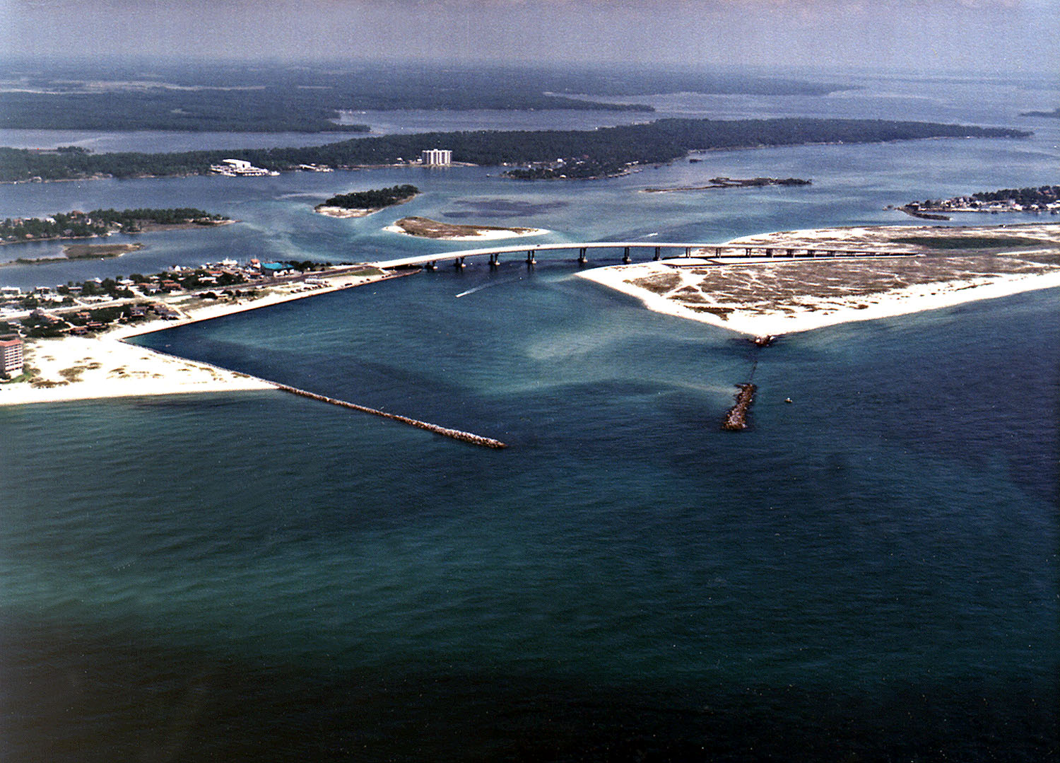
English: Perdido Pass, the mouth of the Perdido River and Perdido Bay on the Gulf of Mexico at Orange Beach, Alabama, USA. Alabama State Route 182 crosses the inlet. The image description on the USACE source page has misidentified the highway on the bridge as U.S. Route 98. |
|||
| الموقع | Orange Beach, Alabama, USA 30°16′40.96″N 87°33′18.72″W / 30.2780444°N 87.5552°W |
|||
| التاريخ | not specified | |||
| المصدر |
U.S. Army Corp of Engineers Digital Visual Library Digital Visual Library home page Image page Image description page |
|||
| المؤلف | Adrien Lamarre, U.S. Army Corps of Engineers | |||
| الترخيص (إعادة استخدام هذا الملف) |
|
تاريخ الملف
اضغط على زمن/تاريخ لرؤية الملف كما بدا في هذا الزمن.
| زمن/تاريخ | صورة مصغرة | الأبعاد | مستخدم | تعليق | |
|---|---|---|---|---|---|
| حالي | 04:35، 14 مارس 2007 | | 1٬500 × 1٬079 (438 كيلوبايت) | DanMS | {{Information | Description = Perdido Pass, the mouth of the Perdido River and Perdido Bay on the Gulf of Mexico at Orange Beach, Alabama, USA. Alabama State Route 182 crosses the inlet. The image description on the USACE source page has misidentified the |
استخدام الملف
الصفحة التالية تستخدم هذا الملف:
الاستخدام العالمي للملف
الويكيات الأخرى التالية تستخدم هذا الملف:
- الاستخدام في ceb.wikipedia.org
- الاستخدام في de.wikipedia.org
- الاستخدام في en.wikipedia.org
- الاستخدام في es.wikipedia.org
- الاستخدام في fr.wikipedia.org
- الاستخدام في ru.wikipedia.org
- الاستخدام في www.wikidata.org